Dr. Hawthorne Bring GIS Innovation to UCF

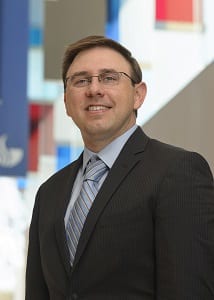
Tim Hawthorne headshot for GSURC
Timothy L. Hawthorne, Ph.D., is an assistant professor of geographic information systems (GIS) in the department of sociology. He is a broadly trained human geographer with deep interests in community geography, qualitative GIS, and critical GIS. Dr. Hawthorne’s research and teaching utilizes innovative methods to integrate qualitative data and mixed methods into GIS analysis. His published work focuses on: 1) accessibility to healthcare, social services, urban greenspaces, and higher education; 2) critical GIS and qualitative GIS including new methodologies such as “satisfaction-adjusted distance measures” to healthcare providers and “critical reflection mapping methodologies” for examining the socio-spatial perceptions of new research sites; and 3) geographic education, service learning, and international education.
Geographic Information Systems (GIS) are the most prominent form of geospatial technology. The Environmental Systems Research Institute (ESRI, 2014) defines GIS as an integration of “hardware, software, and data for capturing, managing, analyzing, and displaying all forms of geographically referenced information. It allows users to view, understand, question, interpret, and visualize data in many ways that reveal relationships, patterns, and trends in the form of maps, globes, reports, and charts.”
Within sociology, this new area of GIS allows students to broaden their skill-sets and become more attractive for future careers in the academic and non-academic world. GIS is an incredibly powerful research method and framework for analyzing social and environmental inequalities, accessibility to social services and education, and other human behaviors. GIS also allows for a highly visual form of communication. GIS technology offers a gateway for students and the general public to delve more deeply into the most complex social and environmental issues of our time while understanding connections across multiple geographic scales.
Dr. Hawthorne believes this new area in sociology will allow students to interact closely with community-based organizations and local residents here in Florida as well as internationally in Belize through his new international GIS study abroad course in beginning summer 2016. “We’ll use community geography and citizens science methods (mobile mapping, online GIS, participatory sketch mapping, and drone technology) to collaboratively examine social and environmental problems.”
Hawthorne earned his Ph.D. in Geography in 2010 from The Department of Geography at The Ohio State University where he worked under the direction of Dr. Mei-Po Kwan. He received his M.A. in Geography in 2005 from the Department of Geology and Geography at West Virginia University where he worked under the direction of Dr. Daniel Weiner. Dr. Hawthorne is also a 2003 graduate of Ohio Wesleyan University where he received a Bachelor of Arts degree majoring in Geography with a minor in English where he was advised by Dr. John Krygier.
Dr. Hawthorne serves as Chair of the Applied Geography Specialty Group for the Association of American Geographers. He also serves on the editorial board of The International Journal of Applied Geospatial Research. He is Founding Director of The Geospatial STEM Academy funded by The Verizon Foundation. Dr. Hawthorne is a co-founder of the Belize Geosciences Exchange (BGX) program along with Dr. Christy Visaggi of Georgia State University. The BGX program provides opportunities for undergraduate and graduate students from all disciplines to learn about community-based, international research experiences that focus on social and environmental disparities in Belize.
Dr. Hawthorne hopes to develop a new GIS certificate program at the graduate and undergraduate levels. Long-term, he would love to see UCF develop a Ph.D. program around interdisciplinary GIS applications.
Why are you excited to join UCF?
I am thrilled to join the new GIS cluster with Dr. Li (Sociology) and Dr. Branting (Anthropology). The cluster is exciting in that it provides a collaborative space to develop innovative methodologies, research projects, and activities that can utilize geographic information systems and related geospatial technologies while cutting across multiple disciplines. I am most excited about bringing my experiences with human geography, GIS, community geography, and citizen science into this interdisciplinary GIS cluster. The new cluster will challenge me, my collaborators, and our students to think more broadly about how GIS impacts society and how we can more effectively work across disciplinary boundaries.
What do you bring to the GIS scene at UCF?
I bring a passion and enthusiasm for community-based research and teaching. The societal implications of GIS are so incredibly important. In using GIS, we have to recognize research coming from GIS analyses has a large impact on society. What better way to understand this impact than to include communities and residents in the research and education process. My work in community geography/GIS and citizen science seeks to work with communities (rather than research about them from afar) to understand social and environmental inequalities and injustices. I do this mostly through collaborative community-based meetings, online GIS, and mobile mapping applications that include a diverse group of participants such as academics, community members, community organizations, youth, and government entities. By being inclusive in research and teaching, we can move toward more societal-relevant research and education experiences that benefit all of society.
What I hope to accomplish at UCF?
Along with the other GIS cluster faculty, I hope to develop a new GIS certificate program at the graduate and undergraduate levels. Long-term I would love to see UCF develop a PhD program around interdisciplinary GIS applications. I also plan to develop The Orlando Citizen Science GIS Center to provide research and education opportunities for the UCF community to work collaboratively on GIS projects that include community, industry, educational, and government partners throughout the region. Finally, I will be continuing my work in Belize and plan to offer a new international GIS study abroad course in Belize beginning summer 2016.
